Wednesday, June 4, 2014

Landlubbers again

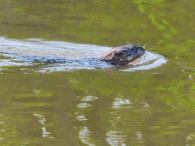
I've obviously been delinquent on updating the blog. We arrived in Castine on Sunday May 25 and have since unloaded supplies from Spray and are now comfortable in our home, with a real bed and shower. That's Spray above, back at her Hatch Cove mooring. She sure did well by us over the past 8+ months.


Backing up to the last blog entry of Wednesday 5/22, we had a somewhat rolly night at a town mooring at Kittery Point Maine, as the mooring field there is open to the east and small swells from the ocean seemed timed to match Spray's natural roll frequency.


We got underway fairly early on Thursday for a foggy 50 mile run up the southern Maine coast to Portland, where we had reserved a slip at DiMillos Marina, right in the Old Port. Here's the Portland Head Lighthouse in the fog.

We walked the dogs up Exchange Street for a visit with our friends at ORPC, and then later joined a few of them for drinks here and dinner here.


On Friday we dallied in Portland some and left the marina at 11 am for a quick 5 mile run to Handy Boat in Falmouth, where we met with ex-Castiner Mary B. for an enjoyable visit. Then in the afternoon we snaked out between the islands of Casco Bay, headed to Boothbay Harbor. Eventually we were out in the ocean headed straight east into an uncomfortable chop so we decided to stop before Boothbay, finding a cove in the lee of Cape Small where we anchored off a sandy beach for the night.


Saturday we rounded Cape Small, crossed the mouths of the Kennebeck and Sheepscot rivers, then past Boothbay and across Muscongus Bay (where we saw some puffins!), to end up in familiar Tenants Harbor, where we grabbed a rental mooring. Even though this was Memorial Day weekend, it was still very pre-season here. We had hoped for a nice supper at the East Wind Inn, but they weren't open yet so we ended up at the Happy Clam, which worked out great as we could bring the dogs to their deck and they had good food and beer.


We liked the Happy Clam enough to return for Sunday breakfast, again with the dogs, and it was sunny and warm on the deck which was great.


[Sidebar about the weather - as noted in the last blog entry we arrived in Kittery Point with sunny weather but a couple hours later the fog rolled in and the temperature dropped into the 50s. Well it wasn't until this Sunday morning that we again saw the sun and decent temperatures. Maine had given us a cold welcome weatherwise. In fact on Saturday's cruise we had started out on the flying bridge and eventually had been driven down to the salon not by rain but by the cold.]


It was mid morning before we left Tenants Harbor, cruised up Mussel Ridge Channel and rounded Owls Head to enter Penobscot Bay. Home waters. Another 3 hours and we were at the entrance to Castine Harbor. Unfortunately we had timed our arrival for low tide, and if we headed right for our mooring in tidal Hatch Cove we would only be able to stare at the dinghy dock which would be on the mud flats. So instead we did a small detour to the mooring at nearby Holbrook Island and took the dogs ashore for a nice walk around the island, one of our favorites.

This killed enough time so we could then head to our mooring and row ashore. We were home!


But not exactly. The water was turned off at the house and we needed the town water dept. to come and reconnect us, and it was Sunday of a holiday weekend. So we actually slept the next 2 nights aboard Spray and spent the days on shore, getting the foot-long grass cut, making the scene at the Bakehouse, visiting with friends, and getting the cars jump-started (Toyota was fine, Miata's battery was kaput).


Tuesday morning was exciting as we had the water turned on, found that the pipes didn't burst, and soon had hot water for showers. Tuesday night we finally slept in our bed. Since then we've been slowly working through a list of tasks such as unloading food, clothing, etc. from Spray, restocking the kitchen, sprucing up the yard (more to do there), buying new Miata battery, and so on. We aren't yet fully back in the groove as landlubbers, maybe we're still a bit at sea, but we'll get there.


I plan a few more entries to this blog. First will be a quick summary of the cruise with some statistics and overall thoughts, then I'll do entries for any cruising we do this summer, so please stay tuned!


Wednesday, May 21, 2014

Getting there

Yes, that's the Maine State flag above, just photographed by Sheila at Ft McClary in Kittery Point, MAINE. In the week since the last blog entry we have crossed Long Island Sound, done the CT shore, the RI shore, Buzzards Bay, crossed Cape Cod then Cape Cod Bay, Massachusetts Bay, and today up the NH coast to land in Maine!
 
Backing up to last Wednesday, we left Port Jefferson NY after a 2 night stay there and crossed the Sound to Guilford CT, a 30 nm run towards the NE. We stayed the night at Guilford Municipal Marina, which would not have worked if we arrived at low tide or in peak season, but for this stop it was a good fit for us. SIL Connie soon showed up and took all of us to her and brother Steve's house (Steve was working in Providence) on nearby Mulberry Point. The dogs played with their lab Seamus and I grabbed a shower and after we returned the dogs to Spray the 3 of us had a great supper at Whitfields restaurant on the Guilford town green.
 
On Thursday we headed back out into the Sound and turned east. Our goal was Fishers Island but 2 things combined to scrap those plans. First, the wind/wave situation degraded after a few hours and second, brother Steve freed himself from work and was available for a dinner that night, which wouldn't be possible on an island. So after only 22 miles of cruising we bailed up into the CT river and into North Cove at Old Saybrook CT. Connie and Steve both showed up and we 4 dined at Penny Lane Pub.
 
On Friday the wind/waves in the Sound were bigger than we liked so we stayed another day in Old Saybrook. There was on/off rain so we caught up on reading aboard Spray, all though we did get to shore for lunch.
 
So it was Saturday when we actually made it to Fishers Island, which is a unique place. Close to the CT shore, its actually part of NY State. It has many beautiful homes and one of the worlds best golf courses. It was only an 18 mile cruise for us to reach West Harbor there and grab one of many empty moorings.
 
[Let me take a minute to mention that, for the last month or so, we have been traveling parallel to peak springtime, which means that the trees have just leafed out, the flowering trees are in full bloom, and the local boating seasons are not yet underway. Some towns have their docks up and running and some (Old Saybrook) don't. Mooring fields are mostly empty so we often can grab a handy mooring to tie to overnight.]
 
We really enjoyed our visit to Fishers Island. We walked much of its west end and it was really beautiful. The island apparently has about 200 year round residents and in the summer the population must at least triple when the 1%ers show up. A nice place to visit pre-season. Check out the view from the golf course.

On Sunday we continued eastwards, trying to time our travel to avoid fighting the fierce tidal current that fills/empties the Sound. With following wind and waves we crossed the whole of Rhode Island during the 48 mile cruise. The last few miles were hairy as we turned left, taking the waves abeam until we entered the Westport River, pushing against strong outgoing current. We tied onto an available mooring at Westport MA and waited for the current and wind to settle down before we dinghied to the nearby beach for a long walk.
 
Monday was Buzzards Bay day, cruising about 30 miles up the bay, hugging its west side some to minimize wave size. We arrived in Onset MA to the Onset Bay Marina and took on 90 gallons of diesel (@$3.98), filled the water tank, and pumped the holding tank. For our night's stay we rented a mooring from the marina.
 
Tuesday was a big day. We left Onset at 8:30 am to catch the flooding tide through the Cape Cod Canal, then turned north for a 40+ mile straight run across Cape Cod Bay and Massachusetts Bay to Gloucester MA, for a total run of 60 miles. That long run straight shot was a slog, with annoying waves on our bow for a good portion of it. Plus doing 7 hours offshore like that, with glacial progress, gets kind of boring. But finally we made it into Gloucester's inner harbor to tie to a city mooring. It was take out pizza for us that evening.
 
Today (Wednesday) we had perfect conditions for a cruise around Cape Ann, then straight to the entrance of the Picataqua River to Kittery Point MAINE! We are on a town mooring. After a visit to nearby Ft McClary for dog play we returned to Spray just before the fog rolled in to create some traditional Maine scenery.
 
From here we head to Portland, then maybe Boothbay Harbor and then maybe Castine by Saturday. We'll see.


Tuesday, May 13, 2014

Wotta Day!

Sunday was a BIG day for us :


80 nm in about 11 1/2 hours. Beats our old record by about 20 nm.


Barnegat Light NJ to Port Washington NY. Left Barnegat anchorage just after 8 am.


Half the Jersey Coast. First real 'beach day' of spring, especially at Gunnison Beach near the top of Sandy Hook. Saw 3 whales! Finback?

Perfect timing of the tides to enter Verrazano Narrows (2 knot current pushing us), cross upper NY Harbor, up the East River (2 - 4 knot current pushing us), and into Long Island Sound.
 

Several tour boats and towboats on the East River. A couple cruise ships departing NY Harbor.

Hells gate was quite a ride : big standing waves just south of it. Big whirlpools just north of it. Saw 11.2 knots on the GPS when turning rpm for 6.5 knots.


As we entered LI Sound we passed NYS Maritime Academy and US Merchant Marine Academy. Looks like NYSMA's cruise ship could use some paint.

Entered Manhasset Bay and tied to free mooring by 7:30 pm and had enough daylight left to walk dogs in Port Washington.


Easy 36 nm cruise yesterday (Monday) east to Port Jefferson NY. Amazingly calm except for final hour. Too windy to cross the Sound today so we hang on the rented mooring here and watch the ferries come and go. Guilford CT tomorrow.


But Sunday was quite a day.


Saturday, May 10, 2014

Jersey Coast


We are half way up the coast of New Jersey, doing our travel 'outside' in the big North Atlantic, rather than inside on the windy, shoaly, NJICW. Since leaving St Michaels MD on Tuesday we've been making good time.


We had easy travel Tuesday heading straight north from St Michaels and passing through Kent Island Narrows, then out the mouth of the Chesterton River and up the east side of the northern Chesapeake. Our 47 nm of cruising brought us up into the Sassafras River and to Turner Creek, where we had spent a few nights on our southbound trip. We like this anchorage as it is right off a county park that provides good space for dog play.

In the evening we rowed the dinghy up into a shallow cove and were amazed by what we were told are 'mud carp' swimming under the oozy mud. We couldn't really see the fish, which can be quite large, but saw their wakes in the mud as they swam around the boat. We saw other critters there too.

Wednesday had 2 cruise goals : to fill up Spray's fuel tanks and to set ourselves up for attacking Delaware Bay. After we left Turner Creek we first went 5 miles farther up the Sassafras to Georgetown Yacht Basin, where their low $3.50/gal price made the 10 mile round trip worthwhile, and we took on 110 gallons. Plus the Sassafras is beautiful. It was a comfortable day for cruising.

Then we headed back to the Chesapeake and turned northeast. The Bay quickly narrowed to become the C & D Canal, and with nice assisting current we transited through to the Delaware River.

We tucked in behind Reedy Island and pushed south for a few miles to a handy anchorage. Well, sorta handy in that we first dropped the hook near a boat ramp, where it was quite choppy from SE winds coming up the Delaware Bay. We launched the dinghy and took the dogs to shore for draining (our first steps in Delaware), then back to Spray, hoist the dinghy, and cruise a half mile back to the lee of Reedy Island where we re-anchored for a much more comfortable night.


So Thursday morning we are at the top of Delaware Bay, and the tide is just starting to ebb, so we repeat the boat ramp / dog draining process and start down the Bay for the 48 mile run to Cape May. Its daunting to note that we still have a long way to travel back to Maine, and that from here on almost all of the travel will be in big waters. No more protected ICW.

Conditions in the Bay were OK, and we had nice assisting current for about 2/3 of the trip. By 3 pm we were turning into the Cape May Canal and soon pulled into South Jersey Marina, where we had reserved dockage. We had time for a quick walk downtown, past many beautiful homes. Spring was in full bloom. That night it was laundry time and supper at a good Mexican restaurant.


Friday's goal was Atlantic City. We awoke to thick fog, so we delayed leaving a bit, which gave us time for breakfast at the marina's adjacent restaurant. The fog lifted, at least at the marina, so we headed out the Cape May inlet into the big Atlantic and turned NE up the Jersey Coast. Unfortunately it was still very foggy out there, with maybe 500 ft visibility, so even though it was cool and damp we piloted from the flying bridge as that is where Spray's radar display is.


There were east winds and ocean swells on our beam, and we had decided that we would try the outside and if we didn't like it we would pull a u-turn back into the inlet and then feel our way up the NJICW, which would be a much longer route. It was Katie Bopp who made the decision by getting very comfortable in her bed as Spray rocked and rolled. We figured, if its good with her, its good with us, and so it was 6 hours of bouncy travel up the outside for Spray and crew. It was about 4 pm when we turned into the Absecom Inlet and then into the Brigantine Anchorage. It was still foggy enough that we couldn't see the casino towers in A.C.


The dogs like this anchorage as there is a nice beach to visit, which we did after their supper. After dog play we had a nice mini adventure using the dinghy's massive 2.5 HP motor to provide a tow to a nice boating family with outboard problems.


Today (Saturday) we were up early, played on the beach, and pulled anchor before 8 am to head back out into the ocean to continue up the coast, this time a 30 mile run up to Barnegat Inlet. It was still bouncy and we made the mistake of starting out driving from the salon, which Katie didn't like and made Sheila queasy too. Soon we transferred up to the flying bridge. As we neared Barnegat we had a traveling companion for 5 minutes or so and even though Sheila was driving, she was able to take some photos also.

By 12:30 we bounced into the tricky inlet here and are now in a protected anchorage.


So we are a little more than half way up the Jersey coast. Right now Sheila is baking corn bread in our oven to go with some chili. Smells good! Tomorrow the conditions look good to make a long 48 mile run on the outside to the top of Sandy Hook. Once there we will decide whether to cruise 4 more miles south to Atlantic Highlands, or continue 15 miles farther north into NY Harbor to anchor behind Lady Liberty. Stay tuned to find out!


Monday, May 5, 2014

Up the Chesapeake

Last Thursday the weather reports improved enough for us to leave our slip at the Hampton (VA) Public Pier at about 11 am, get our holding tank pumped, and head out Hampton Roads Inlet then hang a left to start up the 200 mile long Chesapeake Bay.


Rather than repeat stops made on the southbound trip we tried to hit some new ports. We were partly successful. For example, instead of shooting for Deltaville VA that night we went to nearby Gwynn's Island and passed through Milford Haven Inlet to anchor off the SeaBreeze restaurant. The nearby boat ramp provided the necessary dinghy dock access for dog walks. I had wanted to shorten the trip by coming in from the east via a channel known as 'Hole in the Wall' but it was near low tide and a call to the local Towboats US captain for advice yielded this response :

'You might try it but it'll be tight. Near marker 8 you'll find depths of 3 to 3.5 ft. But if you get stuck I'll be happy to come out and pull you off.'

That decided it....the long way around the island for us, which made the day's run a longish 42 nm.


For a bigger deviation from southbound travels on Friday morning we pulled anchor at a leisurely 10 am for a shorter 28 mile run to unique Tangier Island, nearer to the east side of the bay. We had read the very interesting Wikipedia entry on Tangier and were looking forward to a visit. We weren't disappointed, beginning with meeting the owner of Parks Marina, 83 year old Milton Parks. After tying Spray to his face dock he gave us (all 4 of us!) an extended tour of the island in his golf cart. Milton was born there and spent most of his working life fishing the local waters, and he knows everyone and everything about his island. Here he is aboard his beautiful 45' wooden crabbing boat.
The 2 industries on Tangier are fishing (mostly crabbing) and more recently, tourism. The 600 or so occupants are squeezed onto not many acres of buildable land (which are eroding away) so houses and yards are small, roads are sized for golf carts, and many of the small yards are packed with the graves of earlier residents, plus lots of cats.
We had an interesting evening walk, first seeing the town's dozen or so high school prom goers (we hit prom night!) parade in their best dress around town as residents snapped photos, then dodging the locals as they zipped around the island in their carts, which is apparently the thing to do on Friday night. We also had a crabby supper at Lorraine's Restaurant.
 
Saturday morning we headed out into the bay before 8 am. I had hoped to pick another new stop for us for Saturday night but there was no good option within range, other than to head back to the west side of the bay and after 40 miles of cruising, return to Solomons MD, dropping anchor off Zahnisers Marina, just as we had back in early November. Turns out it was a lucky choice as we walked the dogs to the nearby Calvert Marine Museum which happened to be having a festival day and admission was free! Lots of people having fun, live music, and many activities. I got a kick out of the 'build your own toy boat' activity for kids where they apparently assemble the boats with small wooden mallets : tap tap tap tap tap........
Here's the Calvert Museum viewed from Spray's anchorage :
 
Yesterday (Sunday) morning we left early for a long 52 mile run from Solomons to St Michaels MD, again crossing the bay from west to east. Weather predictions included a gale warning for west winds 20-30 knots so we hugged the bay's western shore as we cruised north then turned east and surfed downwind on 3-4 ft waves for 2 hours. Steering Spray under those conditions is tiring as she wants to yaw from side to side. At 3 pm we dropped anchor in Fogg Cove and rowed into the Chesapeake Bay Maritime Museum dinghy dock. We joined the museum back in October and our membership gives us free dinghy dock access and use of their showers, so we are comfortable in St Michaels.
There's a nice lawn area nearby for dog play, and we've already patronized a couple of restaurants. We'll stay 2 nights here and continue northwards tomorrow.


Wednesday, April 30, 2014

and now through NC


It's time for a blog entry that actually logs our travels rather than dealing with boat electrics or tornadoes. So lets detail our travels northwards through North Carolina, which occurred over the past week and a half and had plenty of variety, in scenery and in weather.


Starting with last Monday's departure from Southport NC, after a 2 night stay riding out weather. Even though we didn't really need it, we got our holding tank pumped and then set off up the Cape Fear River, which was kinda bumpy with wind and waves on our bow. Eventually we turned into Snow's Cut and more protected water, continuing up the ICW to Wrightsville Beach, where we dropped anchor at the same spot we had on our southbound visit. Back in November we could walk the dogs on the beach and watch the surfers. In April its busier and dogs aren't allowed on the beach, so we walked the resorty college town some.


Tuesday was expected to be Hell Day, dealing with four drawbridges-on-schedules and crossing Camp Lejeune with its live fire zone across the ICW. Turned out only to be Heck Day. Even with opposing current almost all the way we made each bridge opening without long delays, and didn't get held up at Lejeune either. Here are some shots of activity at Lejeune :

It was a long 48 nm day, and we were glad to reach Caspers Marina in Swansboro NC to tie up for the night. We had time to offload the bikes and make a grocery run.

Wednesday began with some harried maneuvering getting out of the slip, then hitting the fuel dock to take on 100 gal. diesel (@ $3.70/gal), and heading up Bogue Sound towards Beaufort NC. We had planned for an interesting diversion near Beaufort, which would involve heading out the inlet there into the big Atlantic and cruising another 6 miles to anchor inside Cape Lookout Bight, which is one of the highest rated anchorages on Active Captain. But as we approached Beaufort, and I realized what a slog-against-current it would be getting out of the inlet, and that the 6 mile run would be with beam seas, I wussed out and ordered a left turn at Beaufort, up the Adams Creek and across the Neuse River to Oriental NC, where we were lucky to find space at their newly expanded town dock.

Oriental is one of our favorites, and is a cruisers Mecca, and since the dockage was free we decided on a 2 night stay, even though the weather was glorious on Thursday for more cruising. We breakfasted at The Bean, where the conversation is as good as the coffee, and enjoyed touring the town, both on bicycles or on dog leashes. Here is Spray at the town dock, dwarfed by a steel 45' Florida Bay Coaster with 1,100 sq ft of cabin space (now THAT's a liveaboard).

Of course our leisurely visit to Oriental came at a price, which was windy conditions on Friday as we cruised north on the wide Neuse River, then later when we crossed the Pamlico River. We pulled into BelHaven NC ahead of predicted thunderstorms and tied to their 'downtown' town dock. It was a good place to ride out the very nasty weather that evening.


By Saturday morning the front had passed and we had good conditions for a long day of cruising the upper Pungo River, Alligator-Pungo Canal, and Alligator River, ending up in a slip at remote Alligator River Marina.


Sunday we awoke to glass calm conditions which was pleasing as we were about to cross the Albemarle Sound, which had spanked us on our southbound trip. We departed at about 7 am and after a mile we rejoined the ICW with small ripples on the water. Another hour and we were out in the Sound with 2 ft waves on our bow and soon after had 20 knots of wind and 3-4 ft waves on our bow. Spanked again! An hour and a half of that and we were finally able to turn left and follow a lee shore up the Pasquotank River, to a free slip in Elizabeth City. With the ENE winds we had the slip was a little bouncy but we enjoyed ball/frisbee play with the dogs, coffee at Muddy Waters, supper at Groupers Restaurant, and Monday breakfast at Sydney's Cafe. If a town offers free dockage, we like to reciprocate by stuffing ourselves silly. We did learn that the storms that whacked us on Friday night in BelHaven had spawned tornadoes in E.C. as well.


Monday morning I had time to try out E.C.'s new boaters shower facility before we headed farther up the Pasquotank. The section above E.C. is through very scenic cypress forest. In 15 nm we were at the southern lock into the Dismal Swamp Canal for their 1:30 lock-through, raising Spray by about 8 ft. Another 4 miles and we were tied up to the wall at the Dismal Swamp Welcome Center, just before it started raining.


The rain kept up all night and through most of yesterday (Tuesday). We untied at 8 am and cruised slowly for 15 nm up the canal, crossing from NC into VA and arriving at the north lock for the 11 am lock-through. As you can see here the Dismal Swamp weather was just that. Dismal.

The Deep Creek Lock operator is a great guy who invited the dogs ashore and entertained us on his collection of conch shell horns as we slowly lowered back to sea level. That was a nice respite in an otherwise trying day, what with the rain, poor visibility, and very busy waterways up through Norfolk VA, which must be the busiest seaport in the US.


The strong east winds yesterday hadn't bothered us as we were generally cruising in protected waters. That is until we had to cross Hampton Roads Inlet to get to our destination of Hampton VA. My plan (a poor one) was to head out the inlet, taking the waves on our bow, until I could turn and surf downwind into the Hampton River entrance. What I hadn't planned on was the out flowing water current hitting the incoming wind and raising NASTY 6 ft seas. Spray was pitching like crazy and I was expecting green water over the bow at any time. Sheila and I even donned our PFD's, which we hadn't done the entire trip. To add to the fun a large ship sailed into the inlet at just that time. We held to the plan and after the ship passed made a quick turn to port (turn must be quick as Spray's beam is then to the waves - a big one might roll her) and surely did surf towards Hampton. What a relief when we got behind Ft Monroe which protected us from the big bad Chesapeake. 20 minutes later we tied up in our slip here at the Hampton Municipal Pier, all glad to be alive. The conditions at at the Hampton Roads inlet were the worst I've taken Spray through. It was a good reminder of why things like propane tanks and heavy batteries must be well strapped down.


We've all settled in nicely here in Hampton, with visits to a nearby dog-friendly park, and supper for us last night at a Japanese restaurant. The ugly weather has continued, and we've paid for a 2nd night here to ride out thunderstorms (and yes, a tornado watch). We made a bike-run to a grocery store for some staples and are hoping to be able to start up Chesapeake Bay tomorrow, if the weather will cooperate.


Saturday, April 26, 2014

Weather Report

 
I know I owe the blog a write up of our travels through NC, and that's coming soon, but tonight I want to tell of last evening's weather adventure.
 
We had a windy day Friday of cruising from Oriental NC to BelHaven NC, and the open water sections on the Neuse River and Pamlico River were bouncy. We had departed Oriental early since rain and possible thunderstorms were predicted for the late afternoon and evening and we wanted to be settled in at BelHaven by then.
 
As we cruised north we noticed that a tornado watch had been posted for the region until 9 pm. No big deal since many predictions of thunderstorms in these parts include tornado watches.
 
Our plan works as we tie up to the BelHaven town dock at 2:30 pm, just before a rain squall hits. The remainder of the afternoon is quite windy with a few rainy periods.
 
In the evening we walk the dogs and then leave them on the boat while we head for The Tavern at Jack's Neck for supper. We eat at the bar and one of the big TV's has a weather report saying the tornado watch had been upgraded to a warning and that funnel clouds were seen about 60 miles west of us. The weather radar is full of bright colors and its all headed our way.
 
As we are wrapping up supper I ask the bartender where in town one might run to if a tornado is imminent. He hems and haws and says he figures the brick building the tavern is in is as good as any. A fellow down the bar mentions that 'you'll know a tornado is coming if you here the town fire whistle go off'.
 
So we head back to Spray (only a couple blocks away) and marvel at the balmy temps and impressive lightning from the west. Once aboard I'm glued to my iPad watching weather radar as the colored blobs approach. The wind and lightning increase and then at about 7:30 the fire whistle goes off!
 
So we quickly batten the hatches, scoop up the dogs, and head out into sheets of rain and crazy wind. We run to the tavern and they welcome the 4 of us in along with some other boaters. As the wind and rain scream outside we sit near the bar and watch the TV weather which is showing tornado funnels and golf-ball sized hail from the town of Washington, 30 miles to the west. The dogs are pretty nervous, what with all the thunder, until one of the tavern owners shows up with some scraps of prime rib (tonight's special!), which takes their minds completely off the weather.
 
The weather rocks and rolls for the next half hour, and apparently a tornado did hit about 5 miles north of town, but then things quickly quieted down and the rain stopped. So we thanked the tavern folks and returned to a wet, but unscathed, Spray. I pumped a couple inches of rain from the dinghy.
 
A couple of Springs ago our friends the Siegels were anchored nearby and also rode out a tornado near-miss. I guess springtime tornados are common around here.
 
It all made for an exciting evening. This morning we awoke to sunny and clear weather, and continued our travels.


Friday, April 25, 2014

Spray's cruising power - Part 4

If you've read the first 3 parts of this analysis of Spray's propulsion system, and future options, then you deserve a treat.  The treat is that this Part 4 will complete the series!

We've looked at the option of repowering Spray with an electric propulsion motor and a bank of batteries.  We only need 30 HP to cruise so it seems a 50 HP motor (37 kW) would do the trick, giving a margin of extra power when needed.  We need a lot of battery capacity, even for the moderate goal of a 100 nm range.  We found that five 85 kwh batteries from the Tesla S sedan might do the trick, although they may be a bit too heavy and are definitely too expensive (around $150,000 today but less in the future).

There is one more major issue which is how to recharge the depleted batteries after our 100 nm of cruising.  The ideal scenario would be an array of solar panels, such as shown above.  Free green energy.  The photo above looks to be around a 1,000 Watt installation, so lets use that.  Unfortunately solar panels only produce their rated power under very ideal conditions : sun directly overhead and very clear air.  Mr. Google tells me that a real 1,000 W system, mounted horizontally on a completely cloudless summer day, might produce 4 kwh of energy.  And that's best case.

Recall from Part 2 that we need 428 kwh of energy from our batteries to move Spray the 100 nm.  Sadly we'll need to obtain even more energy than that to refill the batteries.  Remember how the batteries get warm as they discharge, losing 10% of their energy to waste heat?  Well, roughly the same thing happens when recharging, the batteries again get warm and waste (we'll assume) 10% of the charging energy to waste heat.  So to put 428 kwh into our batteries the charging system will need to output 428 / 0.90 = 475 kwh of energy.

Back to our solar array providing 4 kwh of charging energy on a perfect day.  It'll take that array 475 / 4 = 119 days to recharge our batteries.  So we cruise for 2 or 3 days, then hang at anchor until 119 perfectly sunny days occur to recharge.  Not gonna work, is it?

If not solar panels, then what?  Maybe the plug!  When we stay a a marina we usually pay about $5 to plug into a 30 amp., 120 volt supply, so we can run Spray's systems (primarily the fridge) and also recharge her house battery.  For us that $5 is a ripoff as we only use maybe 25 cents worth of electricity overnight.

But if we install honker rechargers for our gigunda batteries, how much energy could we pull from that marina plug in a 24 hour day?  Well it would be 30 amps x 120 volts x 24 hours / 1,000 = 86.4 kwh.  (Now that's getting our $5 worth!)  Much better than the solar panels but we'll need to stay for 5 days to get the 475 kwh we need.

Boats larger than Spray have a different plug they use.  It provides up to 50 amps @ 240 volts and usually costs around $10 per night.  Let's convert to that plug and now in a day we draw 50 amps x 240 volts x 24 hours / 1,000 = 288 kwh.  So now we only need to stay on the plug for 40 hours to recharge.

We've solved it!  All we need is $150,000 for batteries (call it an even $200 K to include the propulsion motor, control electronics, big honking battery chargers, etc.) and we can cruise for 2 or 3 days, travel 100 nm, and then hit a marina for 2 days, paying only about $20 to refuel (right now it costs us about $100 in diesel to cruise 100 nm).

And this isn't just for Spray.  All cruisers will want this.  When a fleet of new electric powered trawlers pulls into a marina and plugs in, the adjacent town will go dim from the power draw!  2 days later the boats all continue on their clean, quiet, low cost way.

So who wants to invest?

Thursday, April 24, 2014

Spray's cruising power - Part 3

In Parts 1 and 2 of this analysis we found the following :
- Spray needs 22.4 kW of power from her propulsion engine as she cruises at 6.5 knots.
- To cruise 100 nautical miles with an electric propulsion system, Spray will need battery capacity of 428 kwh.
- To yield that capacity using 4D type wet-cell lead-acid batteries will require 357 such batteries, weighing around 35,000 lb and costing around $70,000. That would sink Spray and so is not viable.
 
Can high technology provide a solution? A good example of the state of the art of proven battery technology is the Tesla S sedan, which can be ordered with a lithium-ion battery package (photo above) that has a useable capacity of 85 kwh, has a well developed cooling/safety system, and that they warrant for 8 years of everyday use in their car. Five of those will yield 425 kwh of capacity. Close enough!
 
So we have a solution, except for 2 little problems :
 
1) Each 85 kwh battery assembly, with its cooling system, weighs about 1200 lb. That's why it's built as a big flat plate so it can fit on the bottom of the car to reduce handling issues. Spray will need 6,000 lb of these battery units. Even if we place them low in Spray's hull to act as ballast for stability, they are about 3,000 lb heavier than Spray's diesel engine and filled fuel tanks. Its only a sixth the weight of the required lead-acid batteries but we will need a naval architect to tell us whether Spray could handle the extra weight.
 
2) Its estimated that each 85 kwh Tesla battery costs about $30,000. So we need $150,000 worth of batteries. This explains why the few electric powered cruise boats you can find are expensive science projects and that diesel still completely dominates for yacht propulsion.
 
Maybe I just need to be patient. Even today you Tesla customers can buy a replacement 85 kwh battery for your car for only $12,000, deliverable when the battery warranty expires in 8 years. So Tesla has faith that lithium-ion battery prices will decline in time. Maybe they will be able to lighten the batteries too.
 
As for me, I'm glad I just changed the oil on Spray's diesel. That engine is gonna need to last for many more years.
 
You readers aren't off the hook just yet. In Part 4 of this analysis we will try to figure out how we would recharge our 5 Tesla batteries. Remember that we'll need to do that every 2 or 3 days of cruising.


Wednesday, April 23, 2014

Spray's cruising power - Part 2


I've occasionally wondered : If Spray's diesel engine ever died (not likely but you never know), rather than spend $20k for a replacement diesel, would I want to consider electric propulsion? Rip out the massive diesel engine and the huge fuel tanks and replace with a small electric motor and appropriate bank of batteries. Imagine the benefits :


- No smelly fuel or diesel exhaust. No chance of a fuel leak.

- Nearly silent and vibration free operation.

- No FNR transmission needed.

- Much less waste heat means probably no seawater heat exchanger is needed.

- Much less maintenance. No oil changes. No fuel filter changes.

- Smaller carbon footprint. Motor would be 90% efficient rather than 39% efficient (see last blog entry).

- Could recharge batteries from the sun? No fuel expense?


That's a lot of benefit! Is it for real? Let's look at the realities.


The toughest reality to face is the fact that we must store the energy we use to push Spray along. Diesel's biggest asset is how densely it stores chemical energy : 136 million joules per gallon! Even with its piddling 39% efficiency Spray's 240 gallon diesel capacity yields a cruising range of about 1,000 miles. Even though we usually fill up before the tanks are half empty, we go weeks without even checking the fuel level, knowing that only after 400 or 500 miles of cruising will we want to top off the tanks.


In the electrical world the storing of the needed energy is much tougher. The best solution (today) is the electrochemical battery, either the traditional lead-acid type or a newer lithium-ion type. Lets see how many batteries we would need. To help out the electric solution we'll only require a cruising range of 100 miles (3 days typical cruise or 2 days if we push it).


100 (nautical) miles at a speed of 6.5 knots. That's 100 / 6.5 = 15.4 hours of cruising. Recall that Spray needs 30 HP of engine output for cruising, and that equals 22.4 kW of power. Since our electic drive motor is 90% efficient it will need 22.4 / 0.90 = 25 kW of input power from the batteries. Multiply the 25 kW by the 15.4 hours (energy = power x time) and you yield a needed battery capacity of 385 kwh.


Well, not quite. Unfortunately, as a battery spits out amps (especially at high rates), it heats up, and that heat is wasted energy. Let's assume that our battery is 90% efficient while discharging, ie. that 90% of its stored energy comes out as usable juice and 10% is lost to heat. Now our needed battery capacity is 385 / 0.90 = 428 kwh.


How many 4D marine wet-cell (basic lead-acid) batteries do we need for our 428 kwh capacity? A typical such battery might have a rated capacity of 200 amp-hours, but the battery will live much longer if we only half-discharge it, using 100 amp-hours. Since electrical power in Watts is current x voltage we get 100 amp-hours x 12 volts = 1200 watt-hours = 1.2 kwh capacity per 4D battery. It'll take 428 / 1.2 = 357 of these bad boys to give the needed capacity. Each 4D battery weighs about 100 lb so we are looking at 35,700 lb of total battery weight.


Houston, we have a problem! Spray will need to tow a barge to hold the 357 heavy batteries needed to move her a mere 100 miles. Towing that barge will seriously impact our 6.5 knot cruising speed. Not only that but at around $200 each, we'll need to shell out over $70,000 to buy those batteries, and they won't last forever.


So wet-cell marine batteries are obviously NOT a viable solution. What about more modern battery technology? Check out Part 3 of this analysis to find out!